Welcome to the Saskatchewan Environmental Heatmaps, developed through a partnership between Saskatchewan Pulse Growers and TerraVision360.
These maps provide weather-based insights to support producers and agronomists across Saskatchewan, with a focus on forecasted key environmental and climate conditions. Using data from a 20 km grid of virtual weather stations with hourly inputs (sourced from IBM/The Weather Company), the system generates regularly updated maps that evaluate how recent and forecasted weather conditions influence environmental risk factors.
Environmental and climate heatmaps are provided in parallel to support broader agronomic decisions and general crop management under variable weather conditions. In addition, a frost risk map is produced for each day, allowing growers to monitor and respond to potential frost events.
Due to pulse crops maturing and pre-harvest interval restrictions, the window for fungicide application is generally past. Maps will focus only on climate for the remainder of the season.
Click each image to view full-screen.
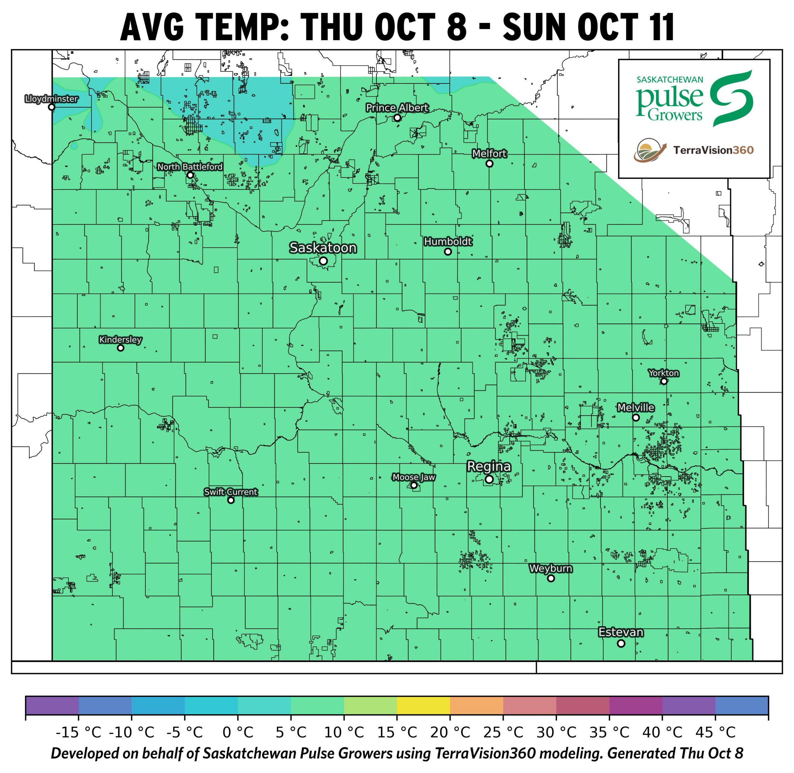
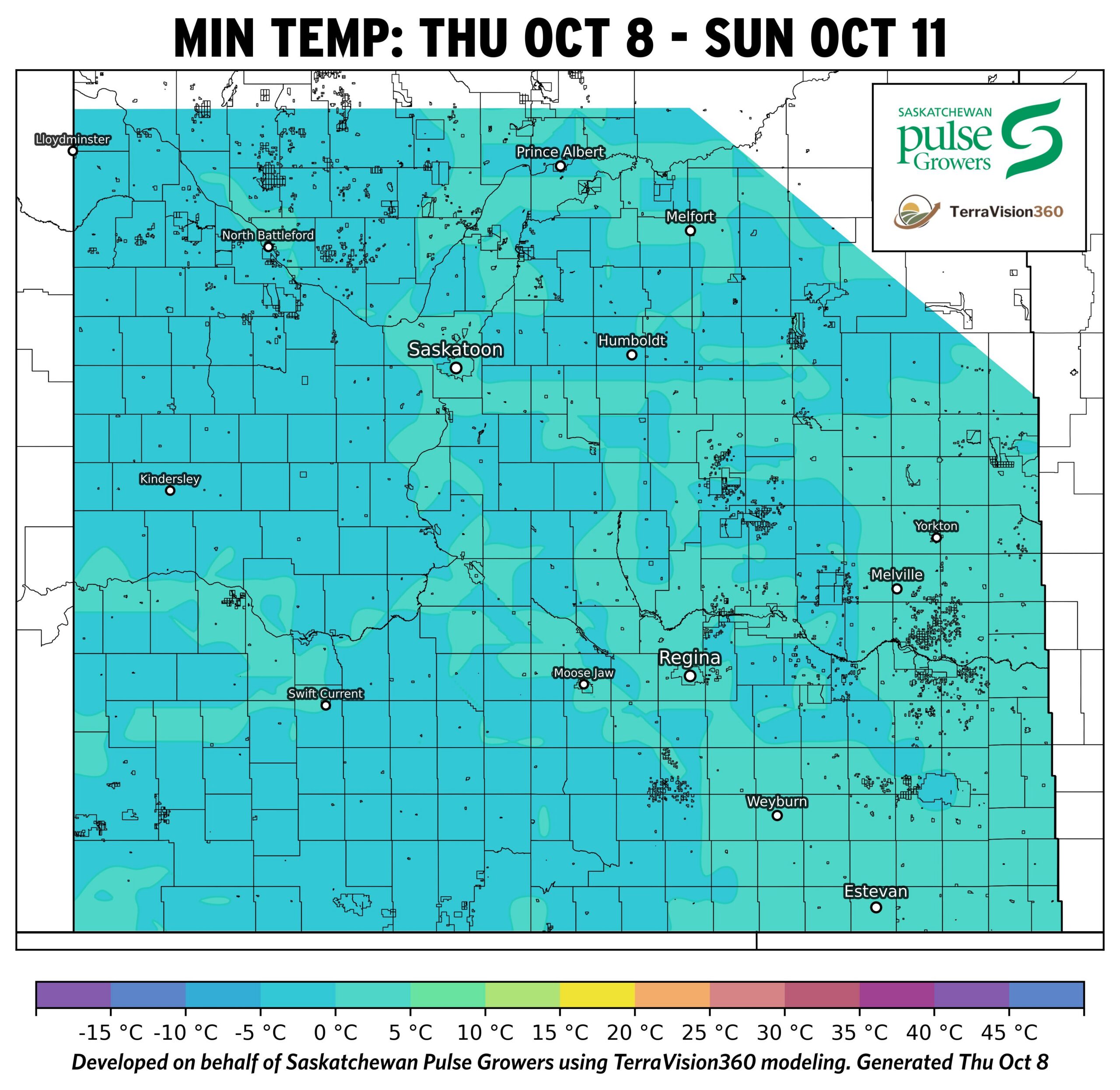
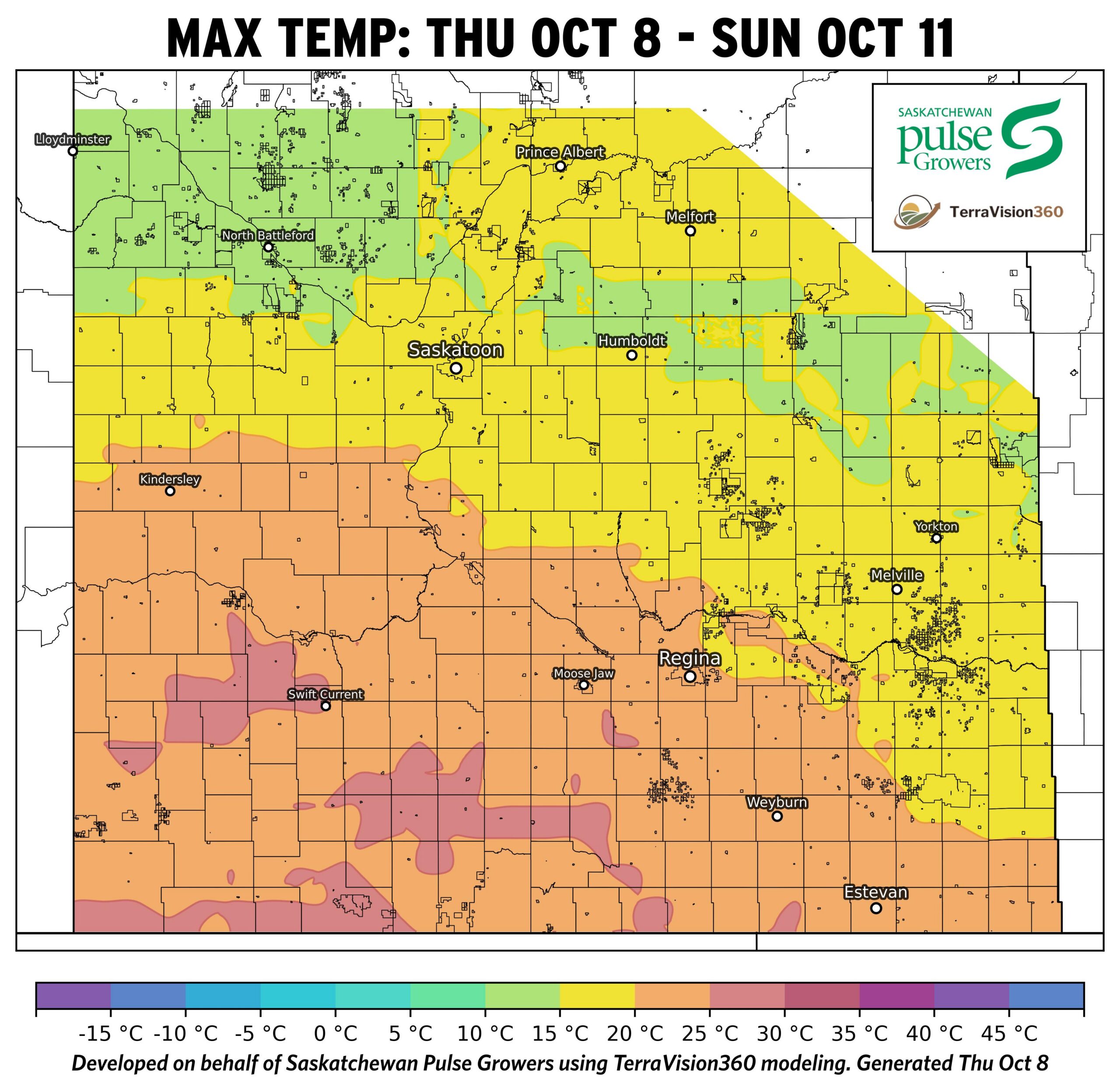
Temperature Maps: Agronomist Notes
- Average temperatures are forecast to remain relatively uniform across Saskatchewan through October 11, generally ranging from 7 to 10°C.
- Maximum temperatures are expected to reach 15 to 25°C across most pulse-growing regions, with the warmest conditions occurring across southwestern and south-central Saskatchewan early in this cycle. Daytime temperatures quickly cool off over the weekend.
- Overnight minimum temperatures are forecast to remain above freezing through Saturday morning, supporting continued harvest progress.
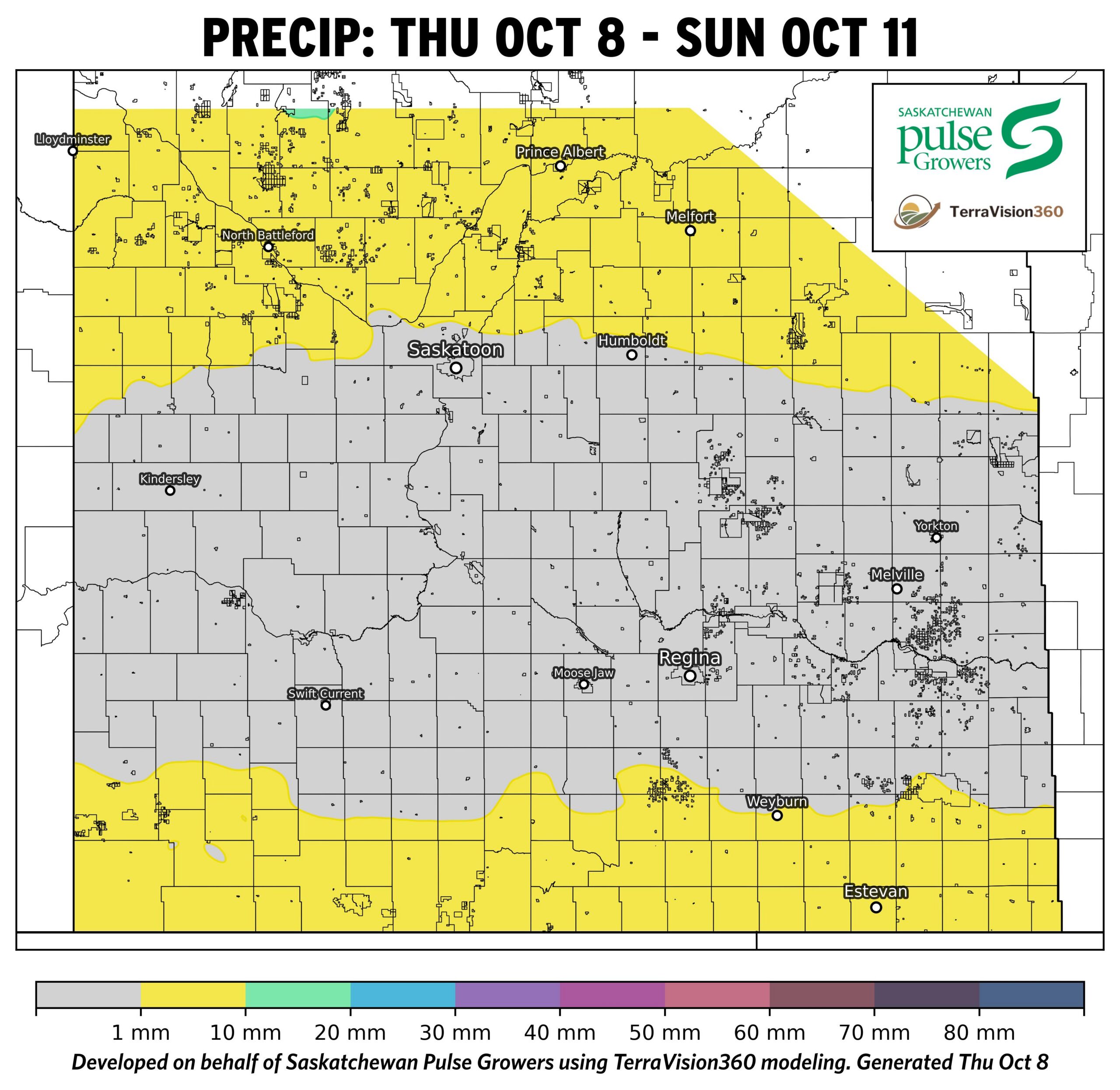
Precipitation Map: Agronomist Notes
- Little to no precipitation is forecast across most of Saskatchewan through October 11.
- Most pulse-growing regions are expected to receive less than 1 mm of precipitation.
- Dry conditions are expected to support harvest operations and field access over the next several days, with minor events potentially delaying the start time for field activities.
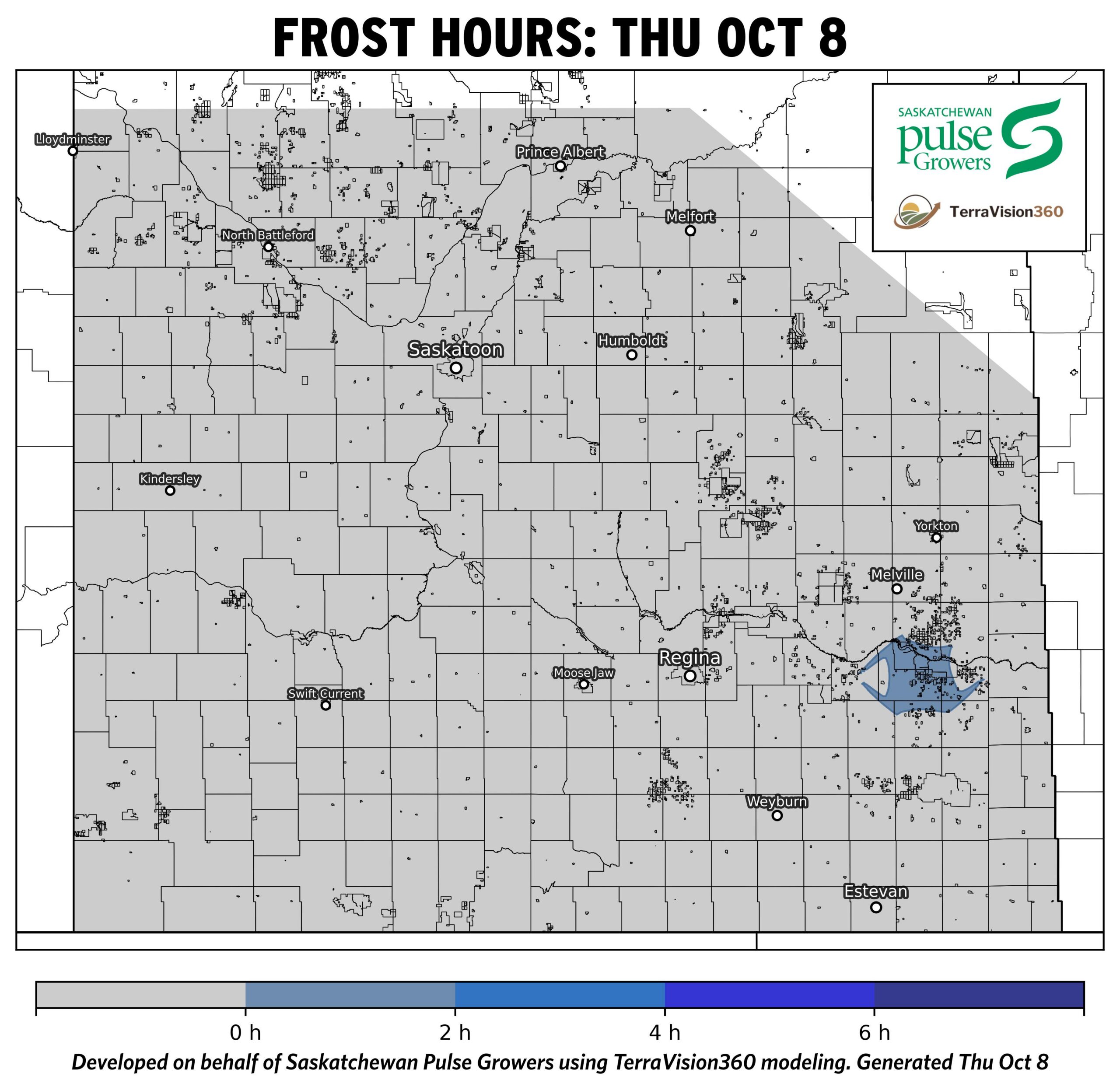
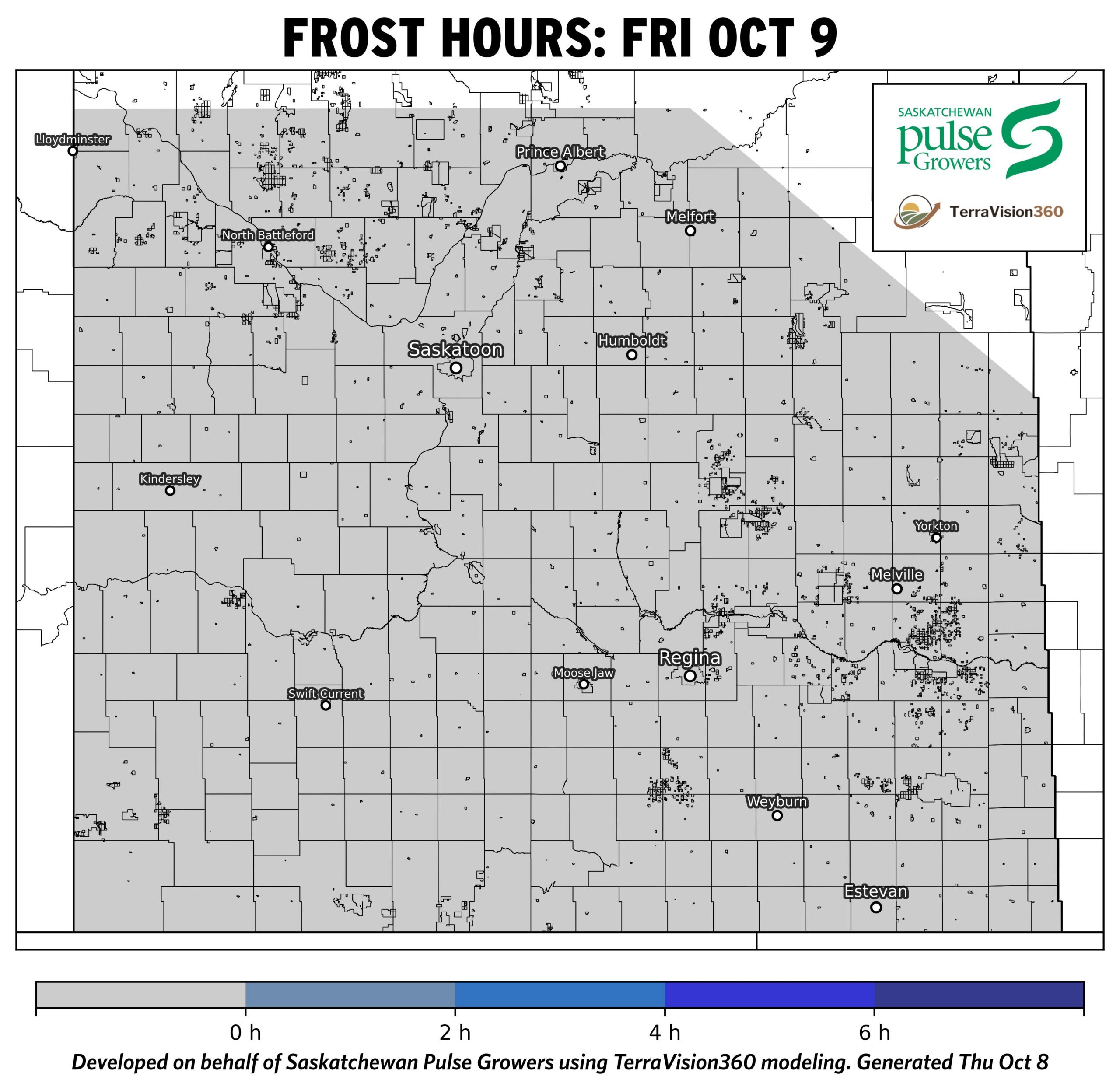
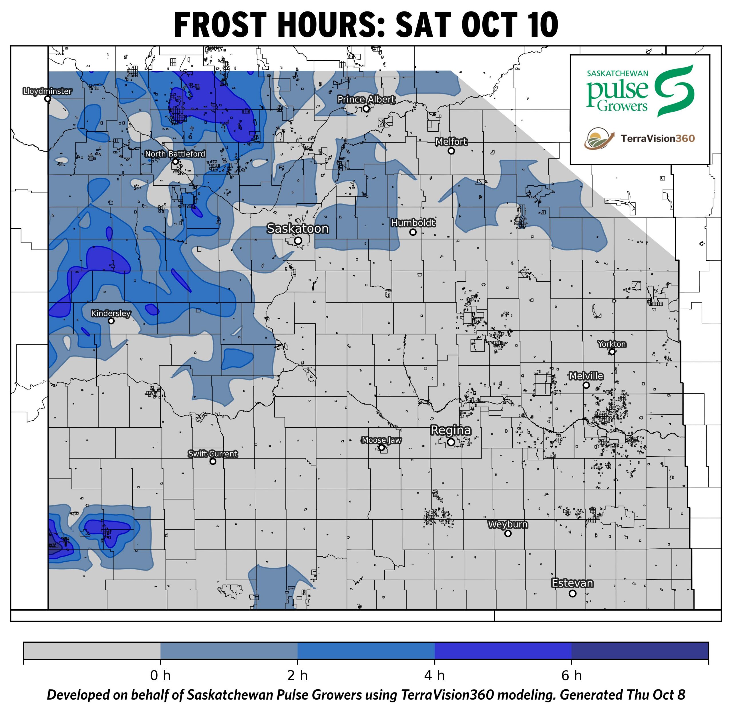
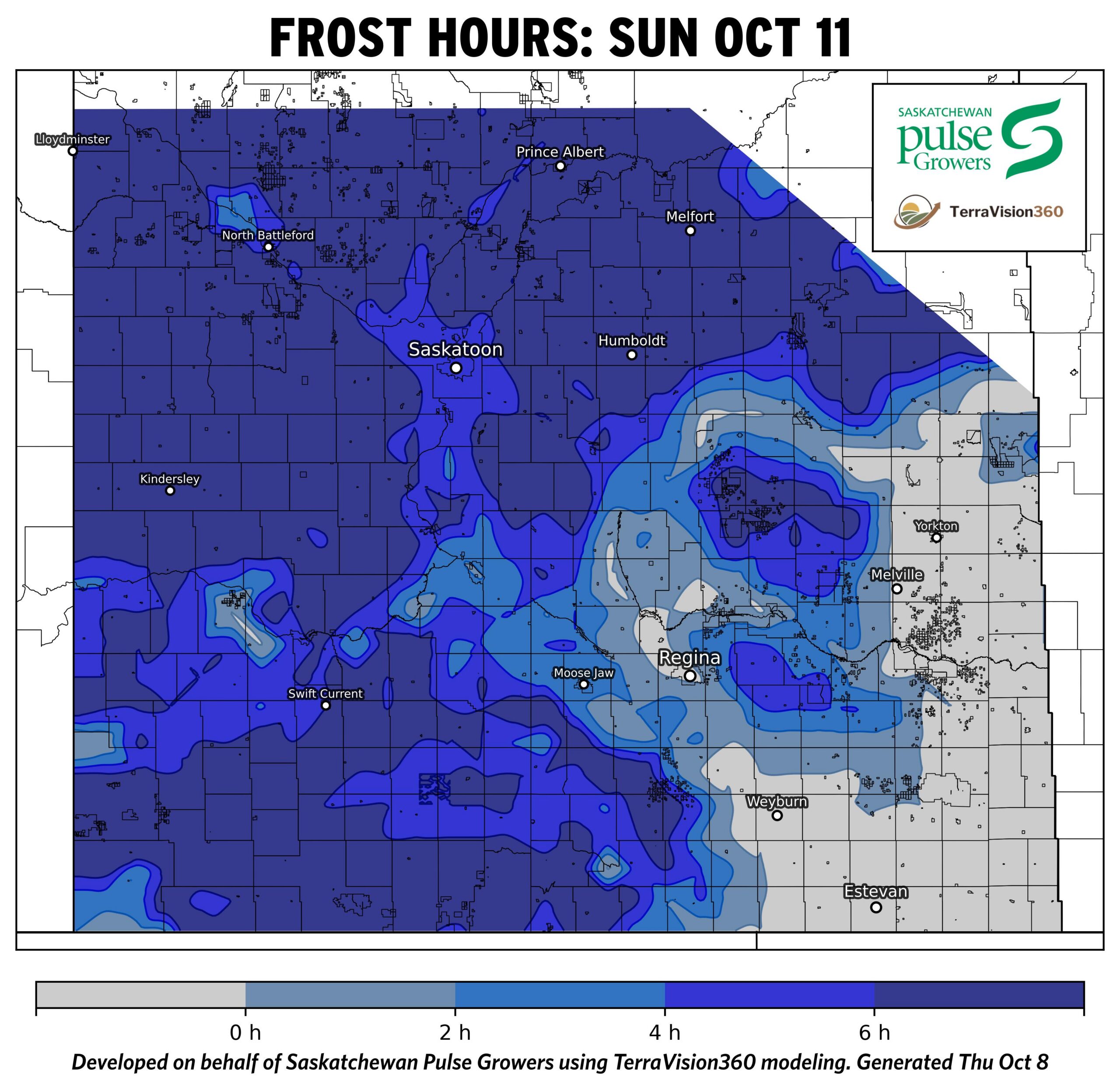
Frost Maps: Agronomist Notes
- Frost risk is limited on October 8, with only a small area near the Manitoba border expected to experience brief frost conditions.
- Frost is not currently forecast for October 9 across Saskatchewan.
- On October 10, localized frost is forecast across portions of west-central and northwestern Saskatchewan, with most affected areas expected to receive 1 to 4 hours of frost.
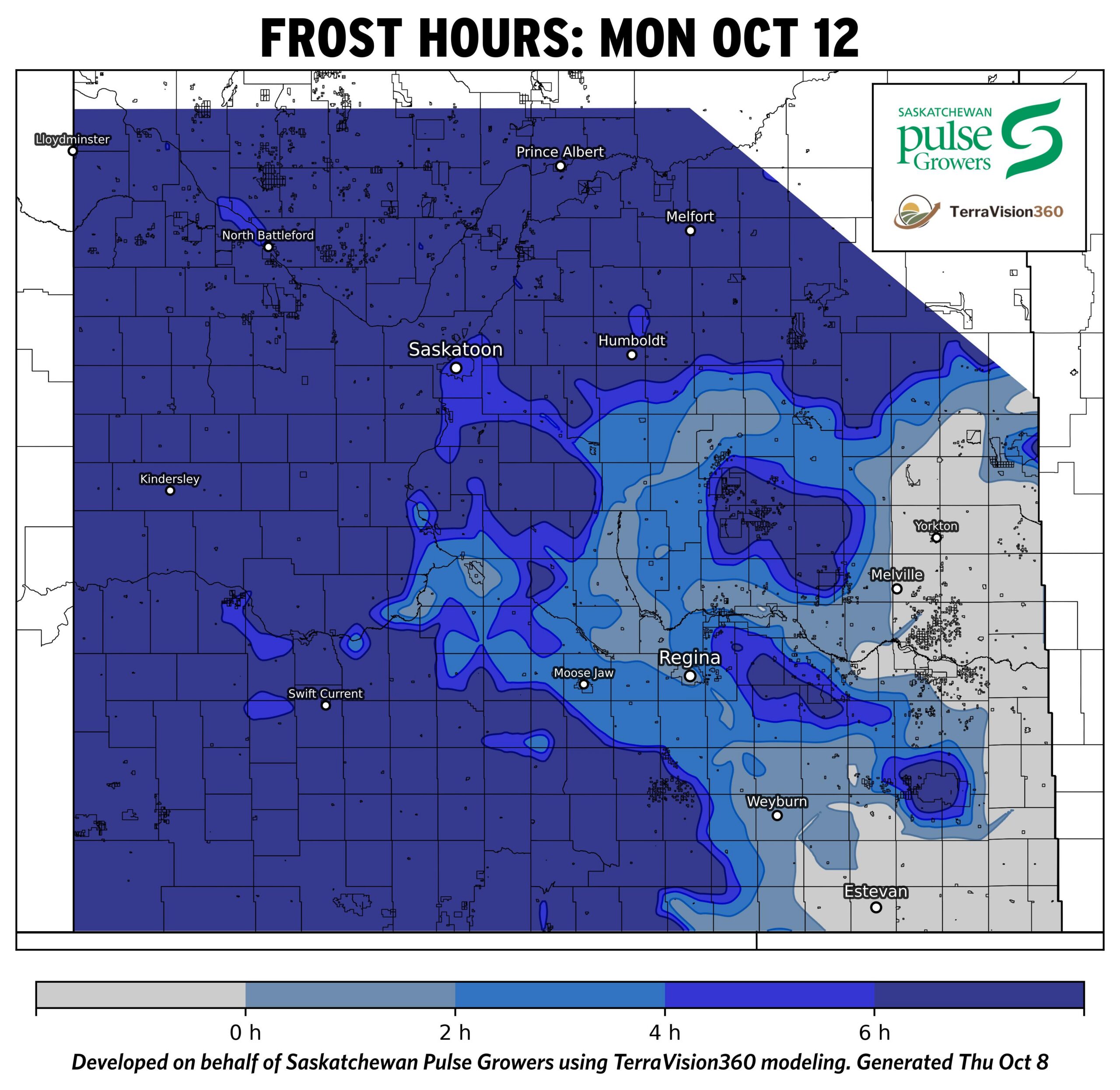
- A widespread frost event is forecast for October 11 and the morning of October 12.
- Most of western, central, and northern Saskatchewan are expected to experience 4 to 6+ hours of frost, while east-central and southeastern regions are generally forecast to receive shorter frost durations of 1 to 4 hours.
- This frost event is expected to be a killing frost to remaining fields that have not yet experienced one due to the event duration, however, as it is not forecast for the eastern regions, where harvest has been more delayed, it is unlikely to impact those pulse acres.
While every effort has been made to ensure the accuracy of these maps, weather-driven models are inherently uncertain, and forecasts may not be 100% precise. All outputs are based on conditions at the time of modeling and are subject to change as weather patterns evolve.
These maps are intended to serve as general decision-support tools only. They should not be relied upon as the sole basis for disease management, spray decisions, or other operational actions. Disease development and crop outcomes may be influenced by local environmental conditions, crop management practices, varietal susceptibility, and other factors not captured in the models. Users are strongly encouraged to verify risk through field scouting, on-site observations, and consultation with qualified agronomic advisors. For disease-specific decisions, refer to additional resources such as fungicide decision support tools and field-level risk assessments.
Information provided through these disease risk and environmental maps are offered to the public FOR INFORMATIONAL PURPOSES ONLY. The map creators and collaborating organizations assume no liability for decisions made or actions taken based on the use of this information.