Welcome to the Saskatchewan Disease Risk and Environmental Heatmaps, developed through a partnership between Saskatchewan Pulse Growers and Ukko Agro Inc.
These maps provide weather-based insights to support producers and agronomists across Saskatchewan, with a focus on forecasted risk assessments of lentil Anthracnose and chickpea Ascochyta, alongside key environmental and climate conditions. Using data from a 20 km grid of virtual weather stations with hourly inputs (sourced from IBM/The Weather Company), the system generates regularly updated maps that evaluate how recent and forecasted weather conditions influence disease development and environmental risk factors.
Disease risk maps are designed to identify areas where environmental conditions are conducive to disease development, based on factors such as temperature, humidity, and precipitation. It is important to note that these maps reflect weather-driven risk only—they do not account for crop stage, pathogen presence, host susceptibility, or field-specific conditions such as irrigation, which may create localized microclimates and alter risk levels.
Environmental and climate heatmaps are provided in parallel to support broader agronomic decisions and general crop management under variable weather conditions.
Click each image to view full-screen.
Lentil Anthracnose Risk Maps: Agronomist Notes
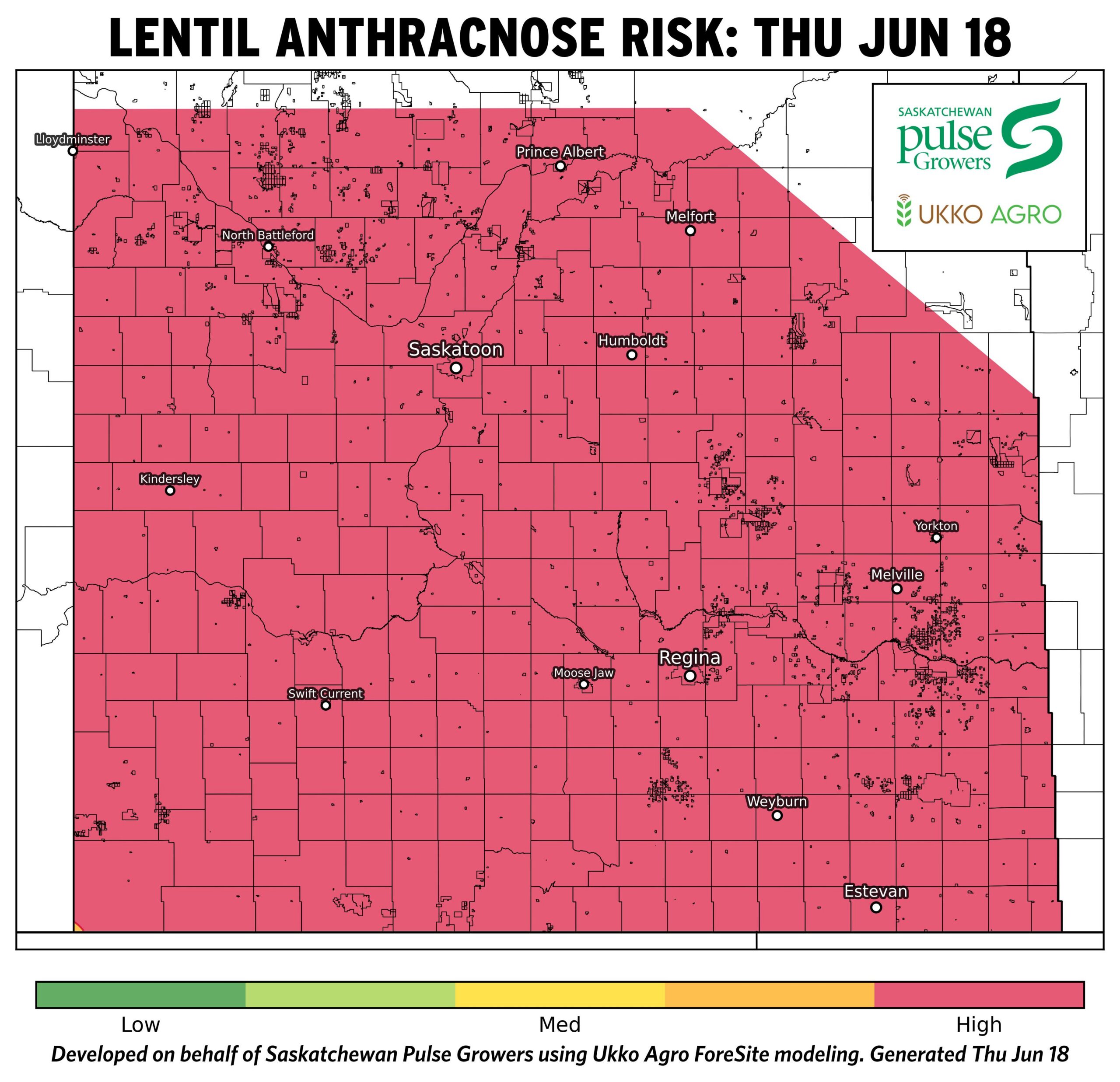
- As of June 18, environmental conditions are resulting in high lentil Anthracnose risk across most of Saskatchewan.
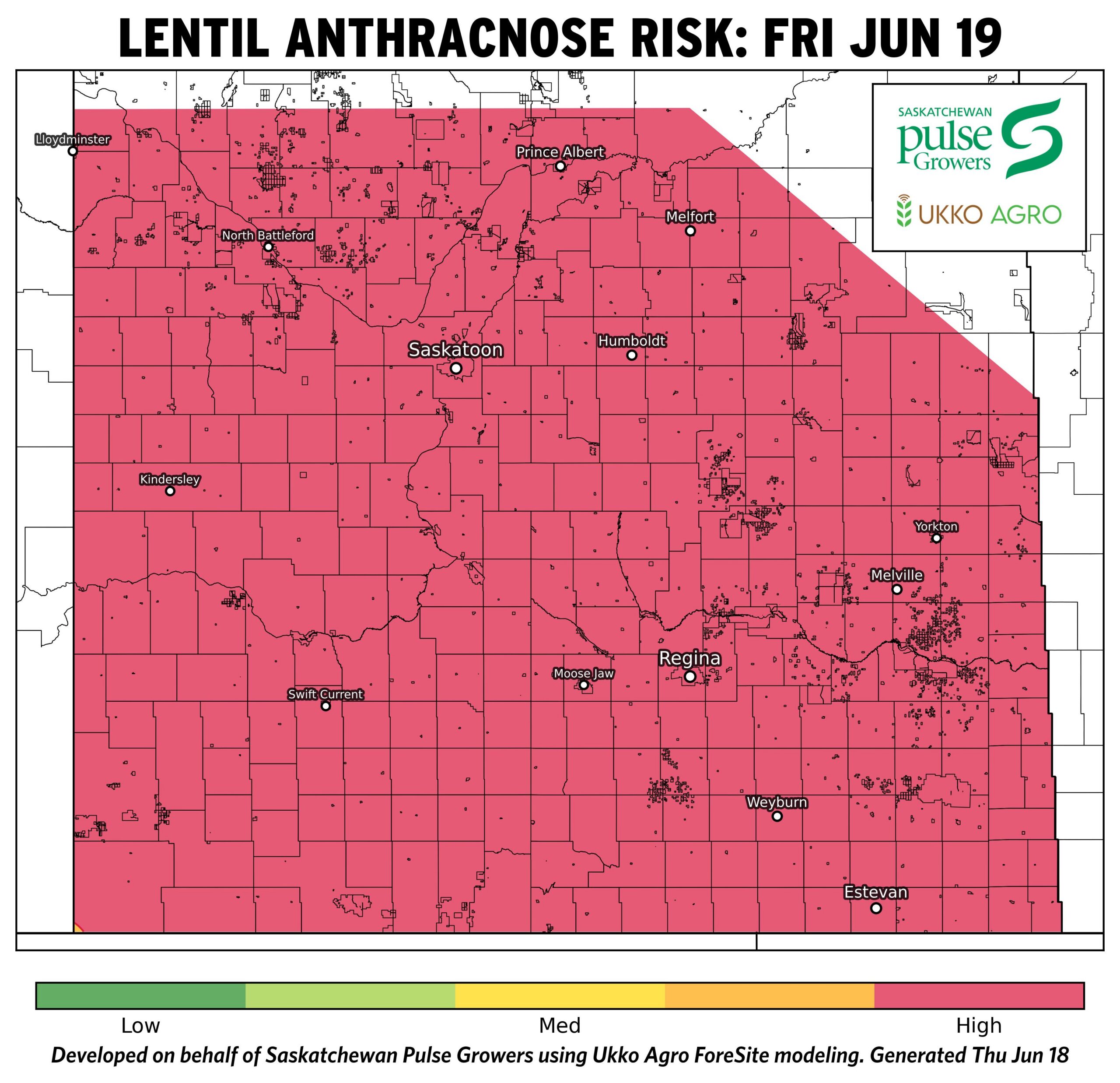
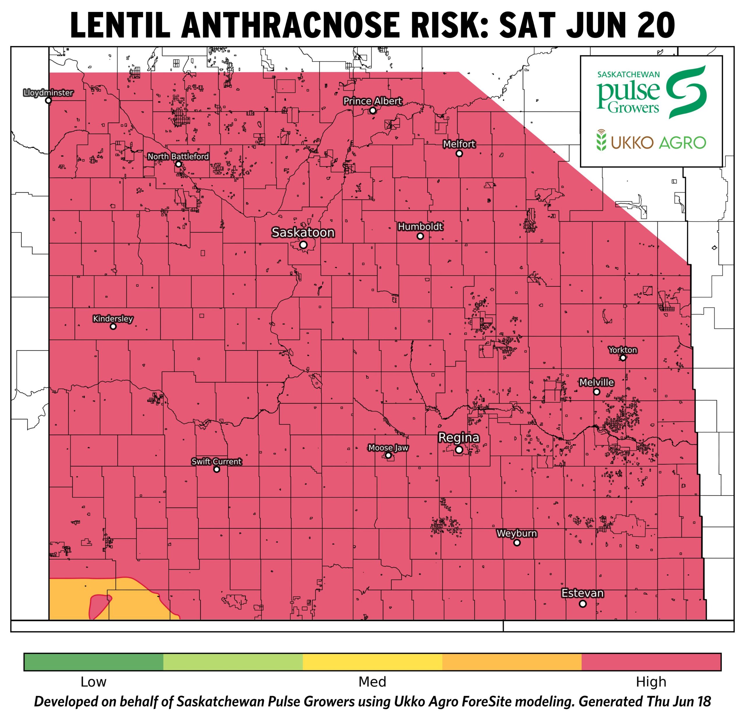
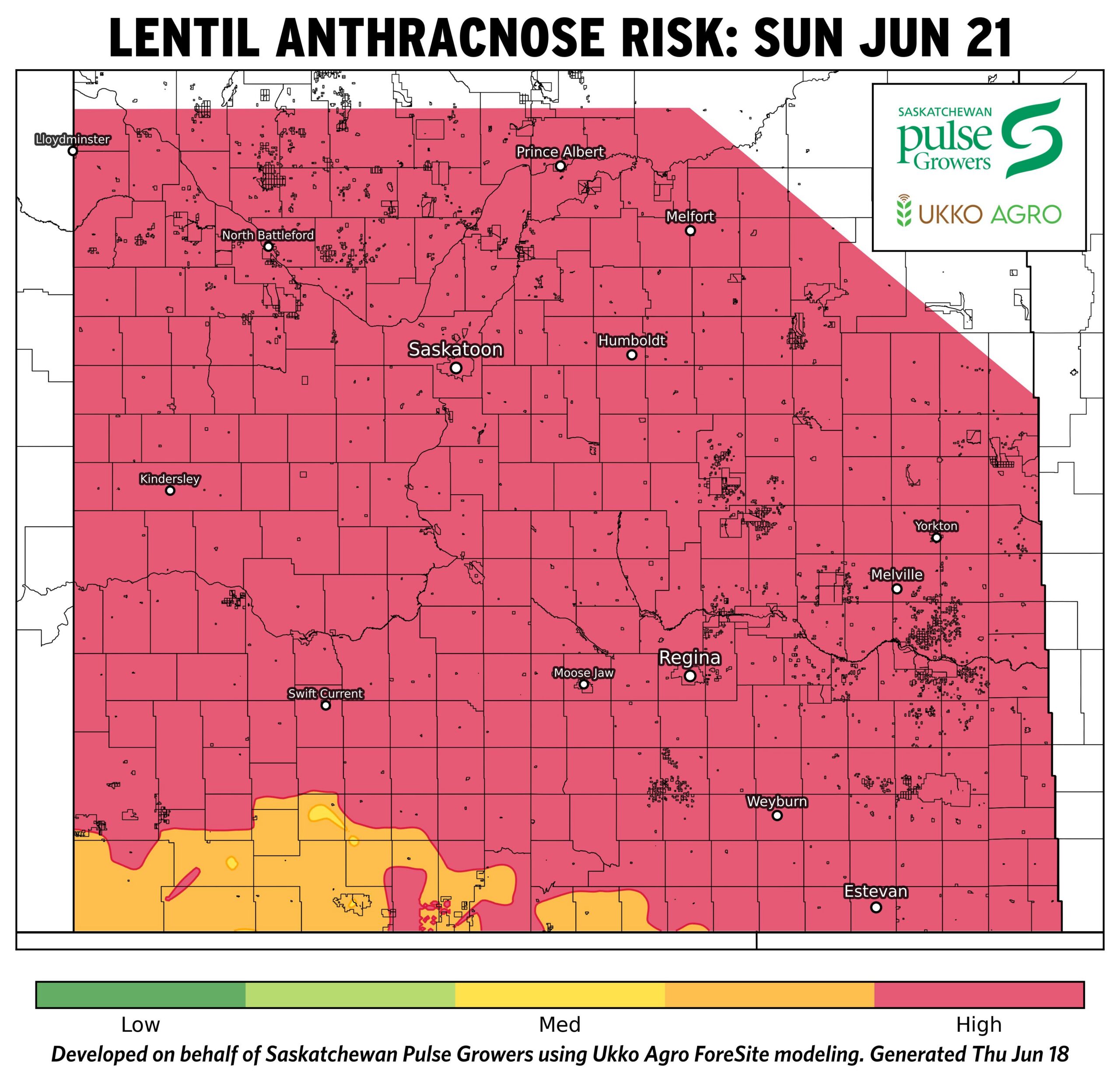
- Current risk maps show nearly all lentil-producing regions in the high-risk category, with minimal regional variation.
- Recent moisture and favourable temperatures have contributed to widespread elevated risk across the province.
- Risk is expected to remain high through June 19–21, with continued favourable conditions for disease development.
- This sustained risk suggests ongoing anthracnose pressure, particularly in fields with dense canopy and/or recent rainfall.
Chickpea Ascochyta Risk Maps: Agronomist Notes
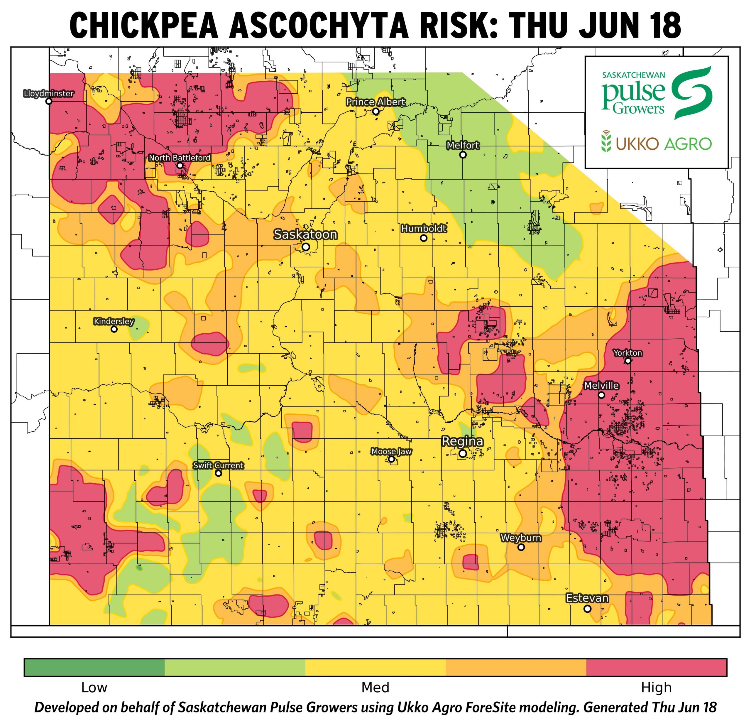
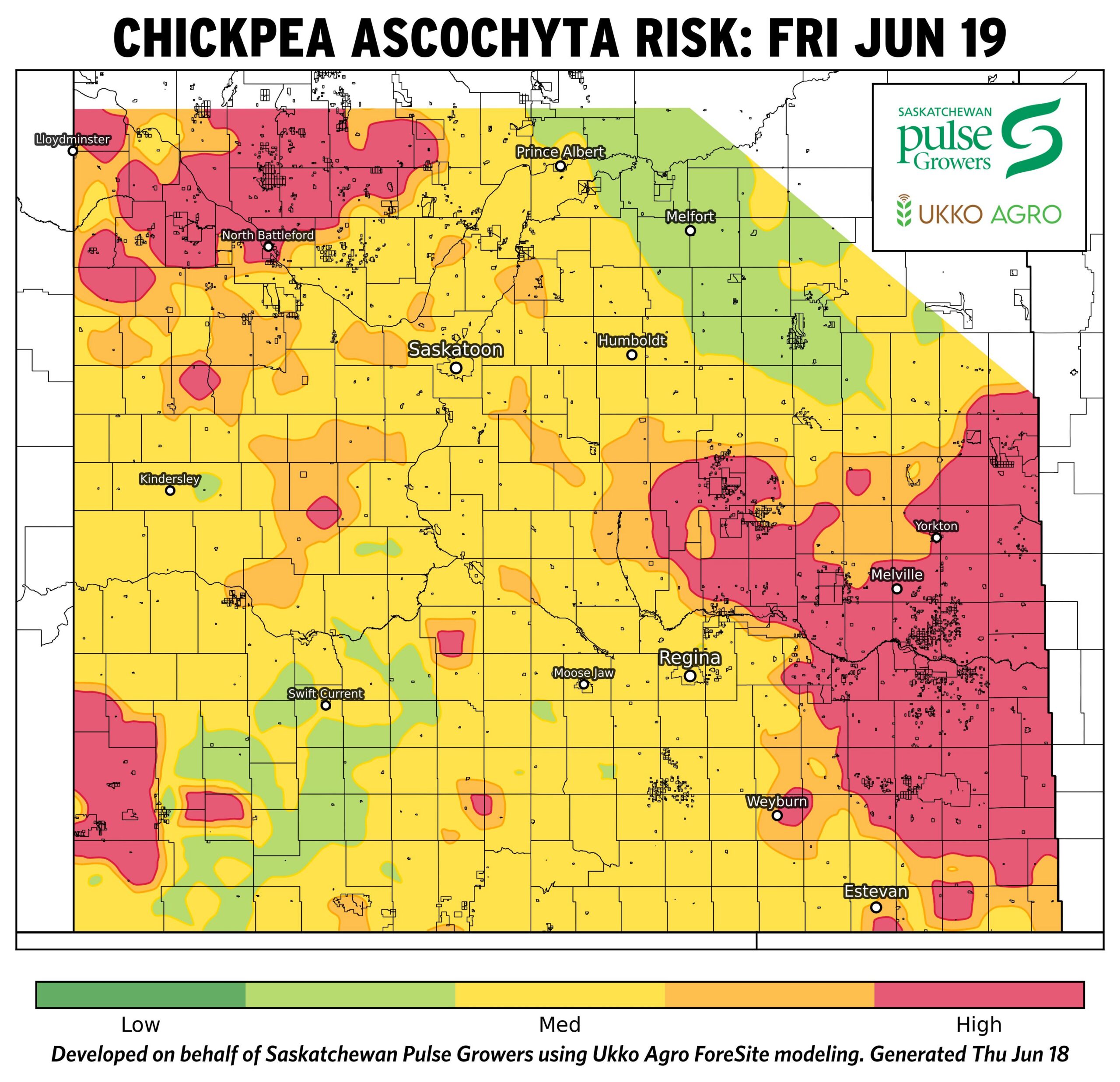
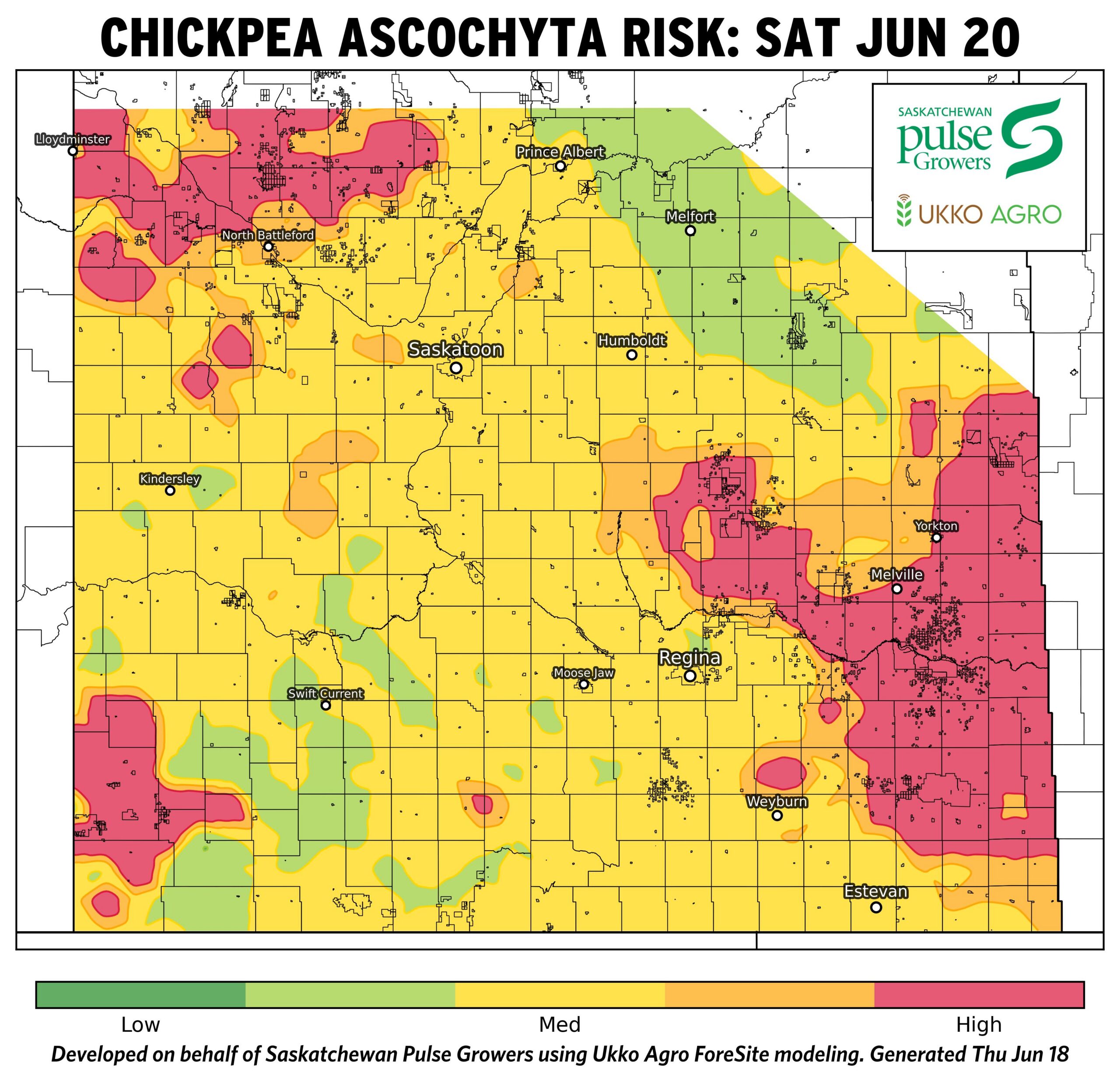
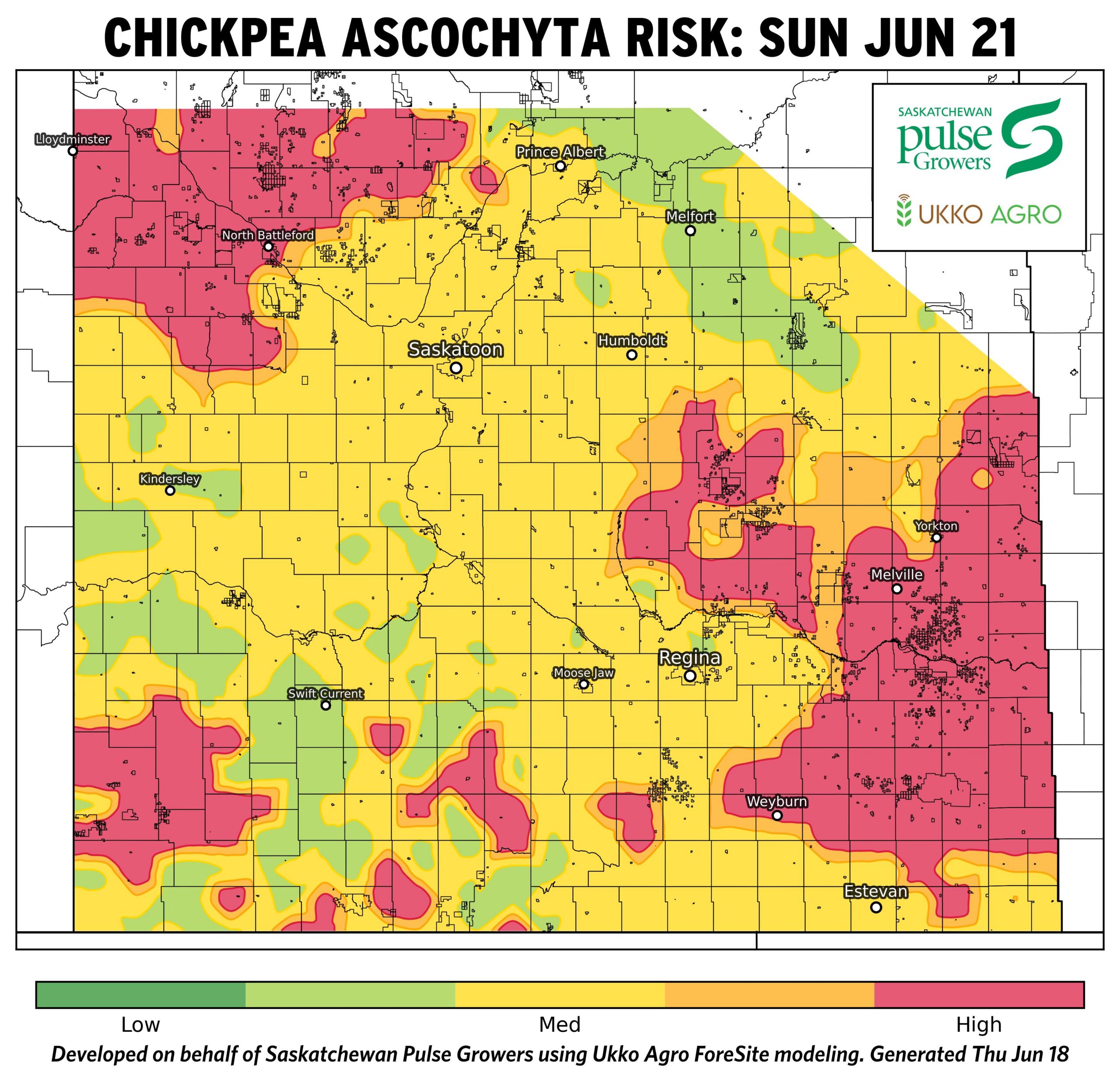
- As of June 18, chickpea Ascochyta risk is variable across Saskatchewan, ranging from moderate to high depending on region.
- Highest risk is concentrated in east-central and southeastern regions, including areas around Yorkton, Melville, and Regina.
- Recent and forecasted precipitation has resulted in increasing risk in these regions, particularly through June 19–21.
- Lower risk persists in parts of the northeast and southwest, where rainfall has been more limited.
- Overall, risk is expected to remain patchy, with localized increases where moisture and canopy development coincide.
Temperature Maps: Agronomist Notes
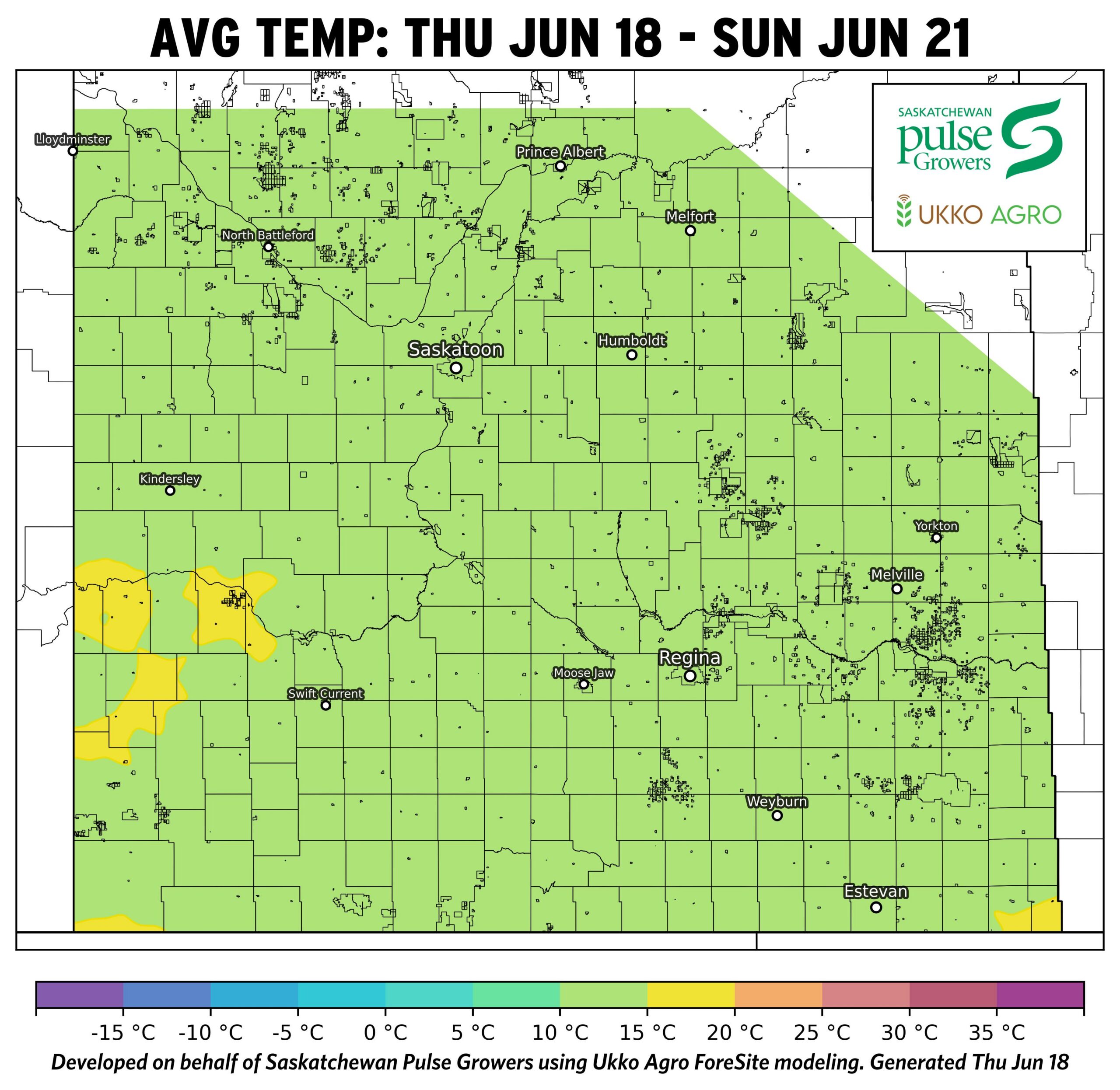
- Seasonal to slightly warm conditions (avg ~12–18°C) across most of Saskatchewan, supporting steady crop development without major stress.
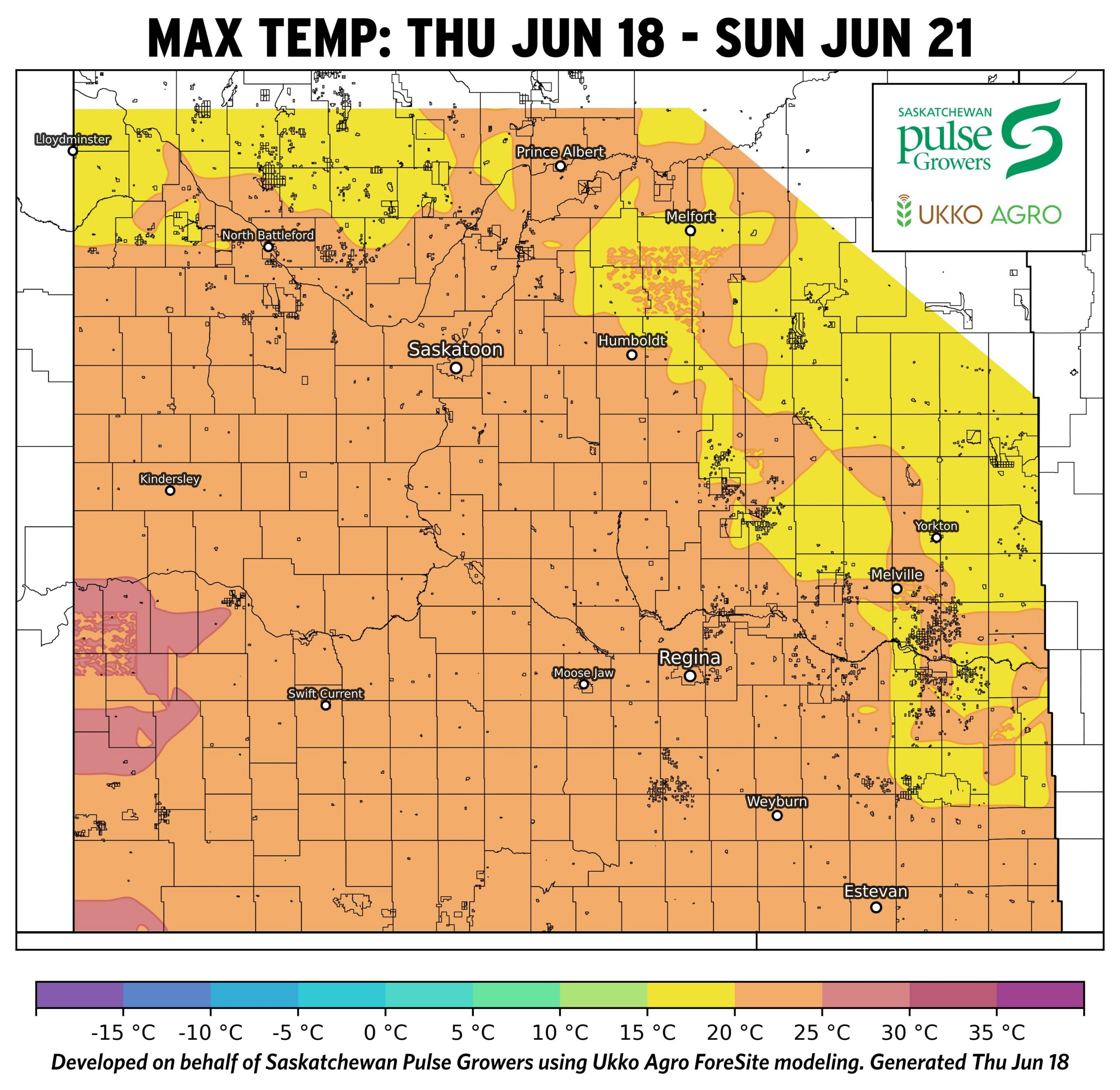
- Daytime highs reaching mid‑20s to low‑30s°C, especially central and western regions enabling crops to advance quickly, but no widespread extreme heat stress.
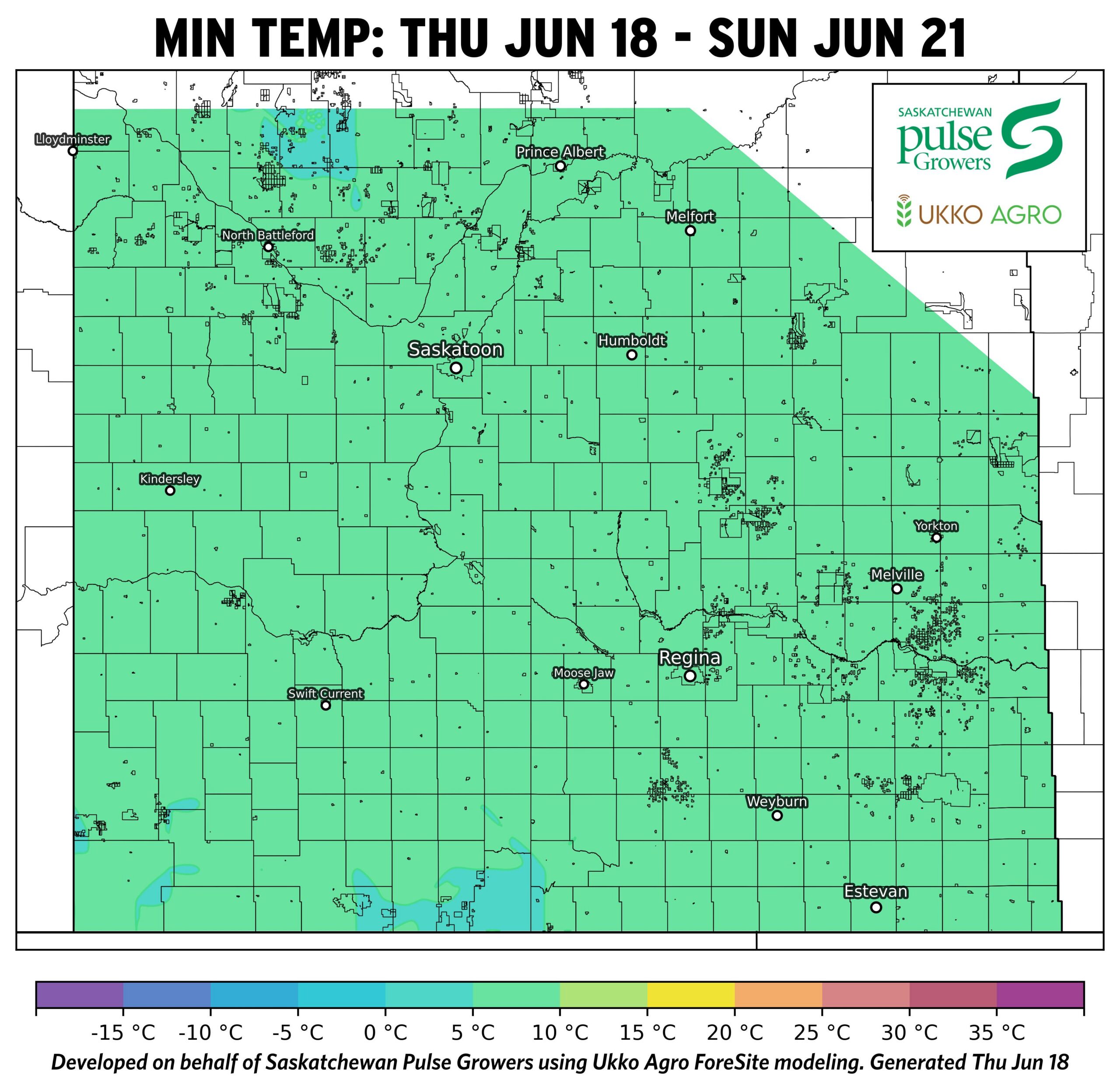
- Mild overnight lows (~8–12°C) reduce risk of cold stress and support continued growth and recovery.
- Overall temperatures are favourable for rapid canopy development, setting up conditions where disease risk is more moisture-driven than temperature-limited.
Precipitation Map: Agronomist Notes
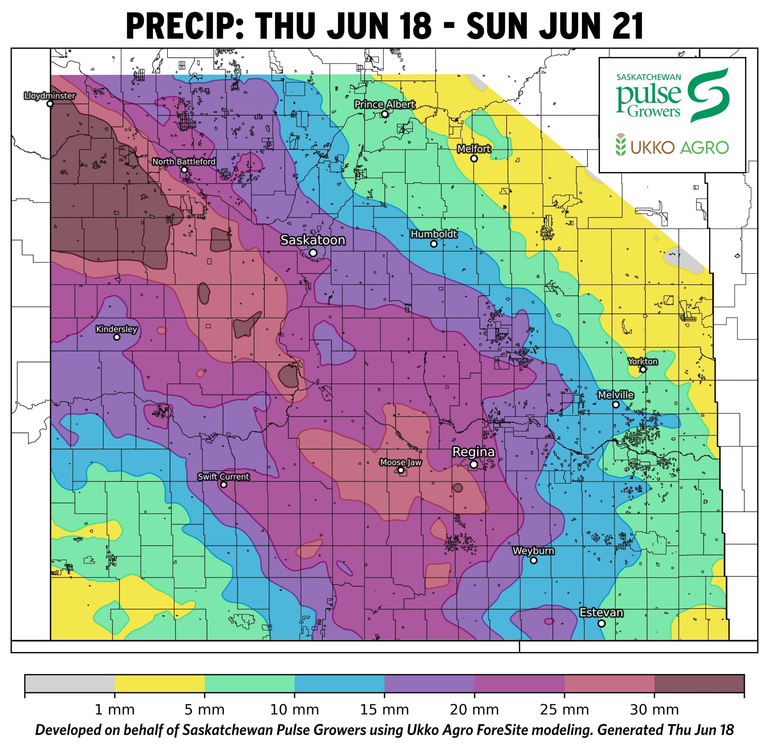
- Heaviest rainfall forecasted from west-central through south-central regions (15–30+ mm) with lighter rainfall in the east and northeast (<5–10 mm)
- Patchy distribution with localized heavier pockets across the southwest.
- Moisture across Saskatchewan is uneven with central/west zones primed for disease development, while eastern areas may remain lower risk unless additional rainfall occurs.
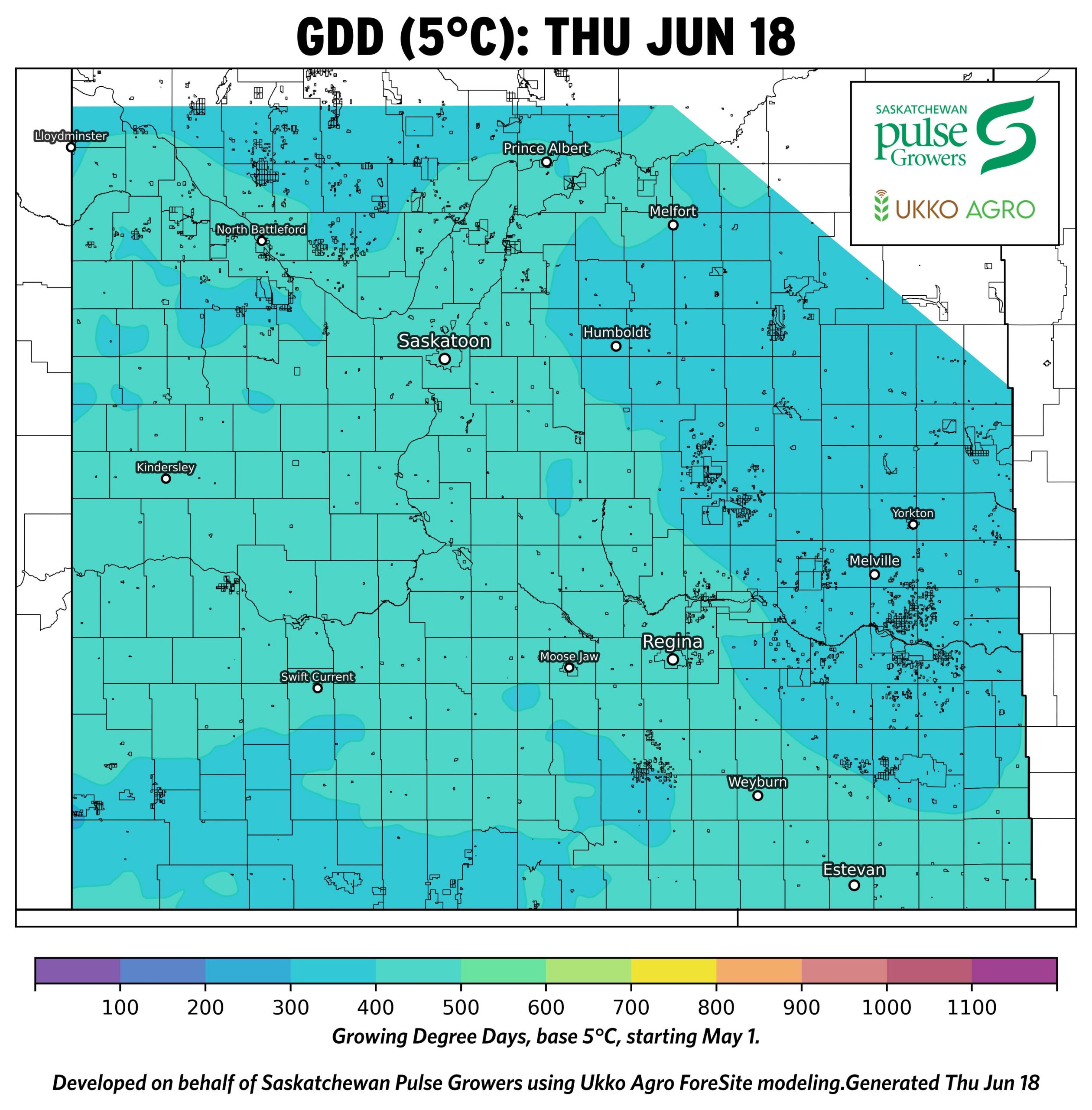
Growing Degree Days Map: Agronomist Notes
- Moderate accumulation (~300–450 GDD) across most of the province since May 1.
- Slightly higher accumulation in southern regions compared to the cooler northern and later-seeded regions.
- Pulses are progressing into early reproductive stages in many areas—timing aligns with key fungicide decision windows, particularly for lentils and chickpeas.
While every effort has been made to ensure the accuracy of these maps, weather-driven models are inherently uncertain, and forecasts may not be 100% precise. All outputs are based on conditions at the time of modeling and are subject to change as weather patterns evolve.
These maps are intended to serve as general decision-support tools only. They should not be relied upon as the sole basis for disease management, spray decisions, or other operational actions. Disease development and crop outcomes may be influenced by local environmental conditions, crop management practices, varietal susceptibility, and other factors not captured in the models. Users are strongly encouraged to verify risk through field scouting, on-site observations, and consultation with qualified agronomic advisors. For disease-specific decisions, refer to additional resources such as fungicide decision support tools and field-level risk assessments.
Information provided through these disease risk and environmental maps are OFFERED TO THE PUBLIC FOR INFORMATIONAL PURPOSES ONLY. The map creators and collaborating organizations assume no liability for decisions made or actions taken based on the use of this information.